6.1 magnitude earthquake strikes Indonesia
Posted on February 4, 2014 by The Extinction Protocol

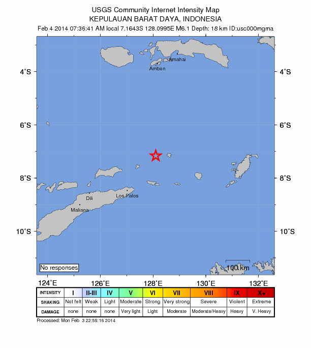
February 4, 2014 – INDONESIA – The U.S. Geological Survey says a magnitude-6.1 earthquake has been recorded in Indonesia. The Pacific Tsunami Warning Center has no warning in effect. The Geological Survey report says the quake hit 197 miles (318 kilometers) east of Dili, East Timor, just after 1730 GMT. The quake’s depth was recorded at 11 miles (18 kilometers). Indonesia is located on the Pacific “Ring of Fire,” an arc of volcanoes and fault lines encircling the Pacific Basin. –ABC News
Thanks to: http://theextinctionprotocol.wordpress.com
Posted on February 4, 2014 by The Extinction Protocol

February 4, 2014 – INDONESIA – The U.S. Geological Survey says a magnitude-6.1 earthquake has been recorded in Indonesia. The Pacific Tsunami Warning Center has no warning in effect. The Geological Survey report says the quake hit 197 miles (318 kilometers) east of Dili, East Timor, just after 1730 GMT. The quake’s depth was recorded at 11 miles (18 kilometers). Indonesia is located on the Pacific “Ring of Fire,” an arc of volcanoes and fault lines encircling the Pacific Basin. –ABC News
Thanks to: http://theextinctionprotocol.wordpress.com


 Sat Mar 23, 2024 11:33 pm by globalturbo

