


 Sat Mar 23, 2024 11:33 pm by globalturbo
https://youtu.be/ZzSV3ikdFso

mavi 777
Published on Mar 6, 2018
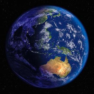
C Google Earth is now a lot of things to remove, hide the truth about the structure of the Earth, so I suggest you see how this is done in this video, half of the video belongs to the channel Unusual object in the shape of a spear on the ocean floor Information about the relief of the bottom is obtained with the help of sonars, or echo sounders installed on ships. Sonar sends deep into the sound signal, which passes through the thickness of the water, until it encounters an obstacle. The sound wave is reflected from the barrier and returns to the top, where it is "caught" by the sonar receiver. By the time of the return of the signal, you can calculate the distance to the object. Having made many measurements in one place, surveyors get an idea of the bottom relief. Modern echosounders measure several dozen times per second. As explained by Scott, the straight lines of the found "Atlantis" correspond to the trajectory of the ships' movement at the time when they include sonnars. Ie again. From the satellite, the relief of the bottom of the seas and oceans is not visible. Therefore, when drawing up a map of the relief of the seabed, bathymetric maps were used. The strips are the path of a ship that traveled with a multi-beam echo sounder switched on to obtain bathymetric data. But after receiving digital data on this profile, they were not processed, but immediately loaded into the database. Therefore, we see data on this profile that are more accurate in terms of depth measurements, they are not processed, many "bounces". more details you can learn here http: http://www.kscnet.ru/ivs/monograph/se ... Satellite altimetry In 1957, after the launch of the first artificial Earth in the USSR, the era of distance research of the Earth from space. Satellite images of the Earth's surface in various ranges of electromagnetic waves contained valuable geological information. tion. However, this information was mainly related to land geology. Only with the appearance of by the beginning of the 1980s of the systems of precise positioning of artificial Earth remote sensing methods have been developed that have great importance for studying the shape of the geoid, the anomalies of the gravitational field and the relief bottom within the World Ocean. These methods of satellite altimetry, based on High-precision (up to the first centimeters) measurement of the position of the unperturbed surface- of the World Ocean with the help of radars installed on satellites.? STING latitude 2 ° 44'15.73 "С longitude 80 ° 15'11.40 "W ROAD 16 ° 57'15.38 "C 66 ° 18'20.74 "W Download for free Google Earth (Google Earth) latest version in Russian. ... It's enough just the Google Earth program to download to your computer, and the magical world of our beautiful planet will open before you https: http://www.google.com/earth/download ... THANKS FOR WATCHING! LIKE & SUBSCRIBE FOR MORE VIDEOS! Twitter: https://twitter.com/mavi777x + Facebook: https://www.facebook.com/Mavi777-4672... Video Credit:Темная сторона Original Video https://www.youtube.com/watch?v=8wzc0... https://www.youtube.com/watch?v=GOFjU...